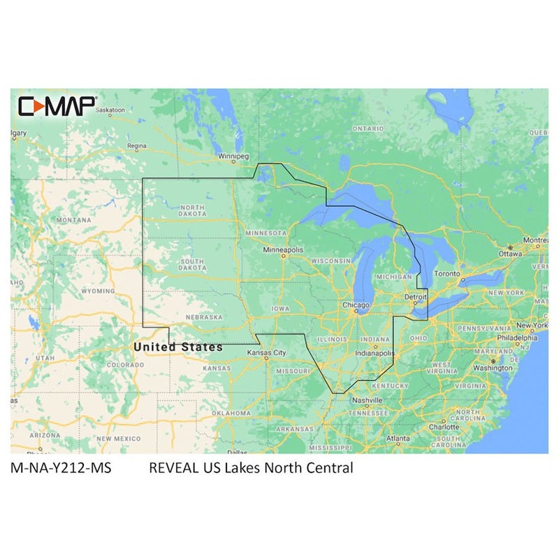
Cruising, fishing or sailing, C-MAP REVEAL Lakes charts offer the very best of C-MAP. With Shaded Relief, including game-changing Reveal Seafloor Imagery, Aerial Photography and Satellite Overlay presentation added to the core C-MAP features found in DISCO
Cruising, fishing or sailing, C-MAP REVEAL Lakes charts offer the very best of C-MAP. With Shaded Relief, including game-changing Reveal Seafloor Imagery, Aerial Photography and Satellite Overlay presentation added to the core C-MAP features found in DISCOVER full-featured Vector Charts, with Custom Depth Shading and subscription-free Easy Routing. It also includes the very best of C-MAP High-Res Bathy, including integrated Genesis data. Purchase includes a full 12 months of online updates.
Compatible with Lowrance, Simrad & B&G Chartplotters.
Copyright © 2025 .All Rights Reserved.Powered by www.flytyingmater.com
Reviews
There are no reviews yet.